|
|
|
|
|
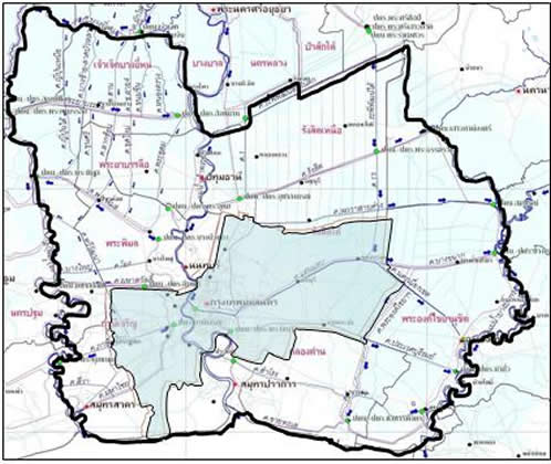
| :: Responsible Area |
| |
:: Eastern Part :: |
|
| |
North - South : |
From the Raphiphat Canal to the Gulf of Thailand. |
| |
East - West : |
From the Nakhon Nayok - Bangpakong River to |
| |
|
the Chao Phraya River. |
|
|
|
|
| |
:: Western Part :: |
|
| |
North - South : |
From the Chaochet - Bang Yihon Canal to the Gulf |
| |
of Thailand. |
| |
East - West : |
From the Chao Phraya - Bangpakong River to |
| |
|
Tha Chin River. |
|
|
|
 |
|
|
|
| The area covers the area of Pathum Thani, Nonthaburi, Samut Sakhon, Samut Prakan
and some parts of other provinces, namely, Ayutthaya, Suphan Buri, Nakhon Pathom,
Saraburi, Nakhon Nayok and Chachoengsao. The total area is 4,975,760 rai (796,122 hectares).
|
|
|
|
|
Since Regional irrigation Office 11 is located at the Lower Chao Phraya River
before discharging into the sea and its topography is lowland, no source of
capital water and retention water, the water shortage problem in the dry season
and flood problem in the wet season is often occurred. Major causes are the amount of
water from the upper, rainfall in the area and high tide.
|
|
|
|
|
Therefore, one of the important tasks of RIO 11 is to prepare the readiness
before the flood season, to mitigate and solve problem during flood period and to
rehabilitate the area after flood season.
|
|
|
|
| |
|
|
|
|
|
| |
|
|
|
|